
Asia Japan
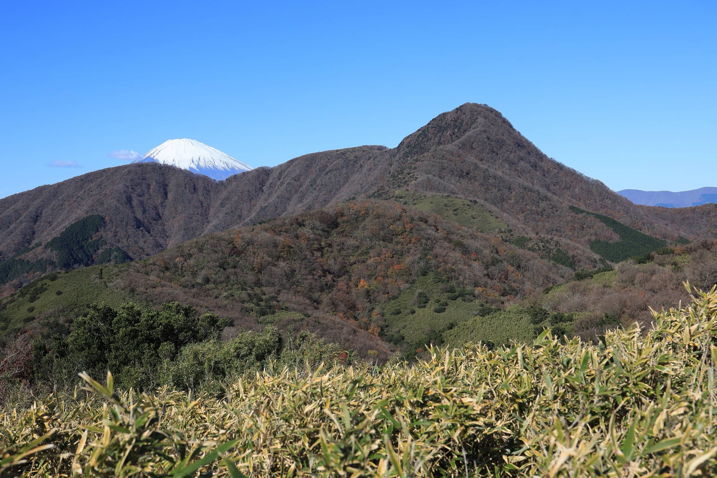
Mount Kintoki
Photo: Alpsdake · CC BY-SA 4.0
The hike
The Environment Ministry's Kintoki-san Course starts at the Kintoki-jinja-iriguchi bus stop in Sengokuhara. You walk 5 minutes to Kintoki Shrine, which honors Kintarō, the strong boy of Japanese folk tales, then climb through the forest past the Kintoki Yadori-ishi, a huge split boulder that legend says was his shelter. From there the trail gets steeper and rockier up to the summit at 1,212 m. You come down a different way, along the ridge to Yakurazawa Pass, and finish at the Kintoki-tozanguchi bus stop. The whole route is 4.6 km and takes about 2 hours 30 minutes.
The view is the reason to come. On a clear day you see the whole of Mount Fuji, from the town of Gotemba at its foot to its summit. To the south you look down on Sengokuhara, Lake Ashi and the steam of Owakudani. Two teahouses sit on the summit, but their hours vary, so bring your own water and snacks. Fuji is most likely to be clear early in the morning and in the colder months, from late autumn to winter.
Official sitePlan your trip
Best months: Nov–Feb
- Permits & fees
- No permit needed.
- Getting there
- From Shinjuku in Tokyo, take the Odakyu Line to Hakone-Yumoto: about 1.5 hours on the Romancecar (extra fee, reserved seats) or about 2 hours on regular trains. From Hakone-Yumoto, take the Hakone Tozan Bus toward Togendai, get off at Sengoku, and change to a bus toward Gotemba. Get off at Kintoki-jinja-iriguchi; Kintoki Shrine is a 5-minute walk away. The hike ends at the Kintoki-tozanguchi bus stop in Sengokuhara.
- Good to know
- Start early. The Hakone Tourist Association says Fuji views are best in the early morning and in the colder months.
- Wear sturdy hiking shoes and bring rain gear. The upper trail is steep and rocky, and some parts get slippery.
- The two summit teahouses keep irregular hours, so carry enough water and food. The summit toilet costs 100 yen.
Gallery
Reviews & tips
Sign in to review Mount Kintoki or add a tip.
Tips from hikers
No tips yet. Water sources, transport, huts — what should the next hiker know?
Sources
- Ministry of the Environment — Fuji-Hakone-Izu National Park: Kintoki-san Course (distance, times, route, views)
- Geospatial Information Authority of Japan — Elevations of 1,003 major mountains (Kintokisan 1,212 m)
- Hakone Tourist Association — Mt. Kintoki hiking trail
- Hakone Tourist Association — Hiking Hakone's Kintoki mountain
- Hakone Tourist Association — Access from Tokyo
- Hakone Geopark — Mount Kintoki (geology, legend, bus access)
- JNTO — The Top 30 Spots for Viewing Mt. Fuji (best viewing conditions)
- OpenStreetMap — Kintoki Shrine (trailhead)
- OpenStreetMap — Kintoki-jinja-iriguchi bus stop
Checked October 2026. Distances and times are typical for the route above; conditions, permits and fees change — confirm with the official source before you go.