Guide
Hiking in the Dolomites: the Tre Cime loop and hut-to-hut basics
The classic loop around the Tre Cime di Lavaredo, how the reservation-only toll road works in 2026, what to expect in an Italian rifugio, and a first look at the Alta Via 1, using details published by the local authorities and the Italian Alpine Club (CAI).
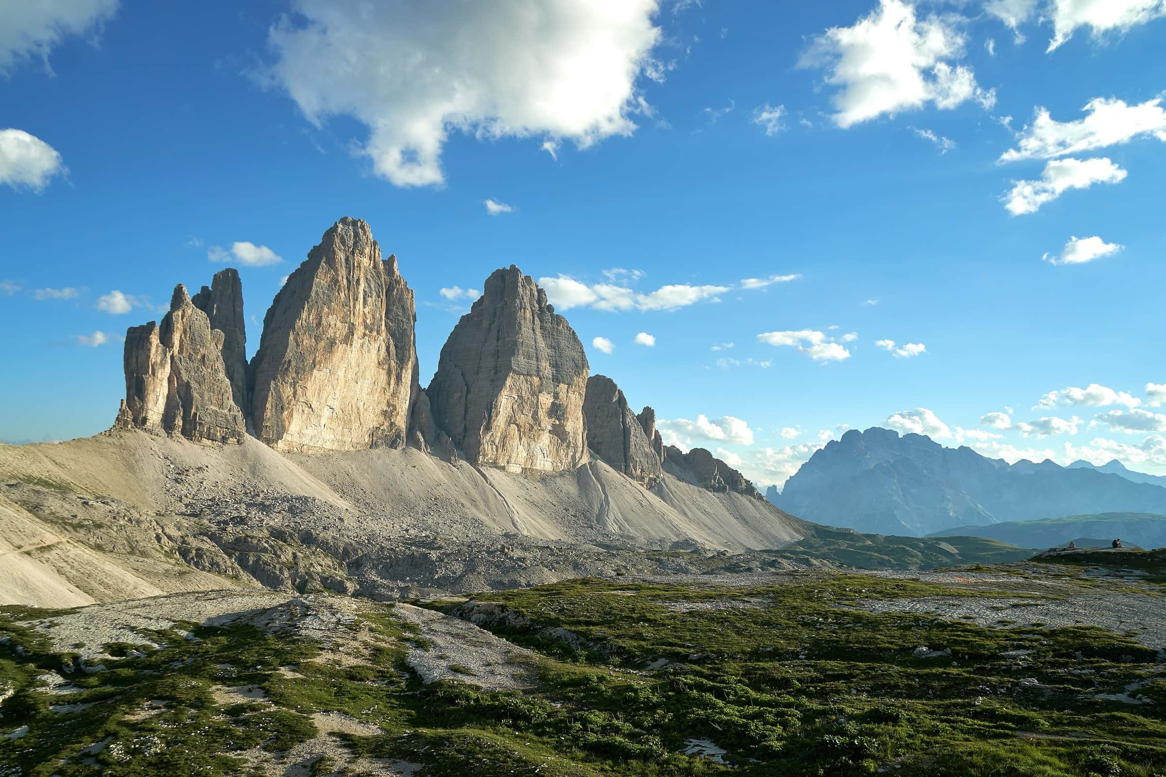
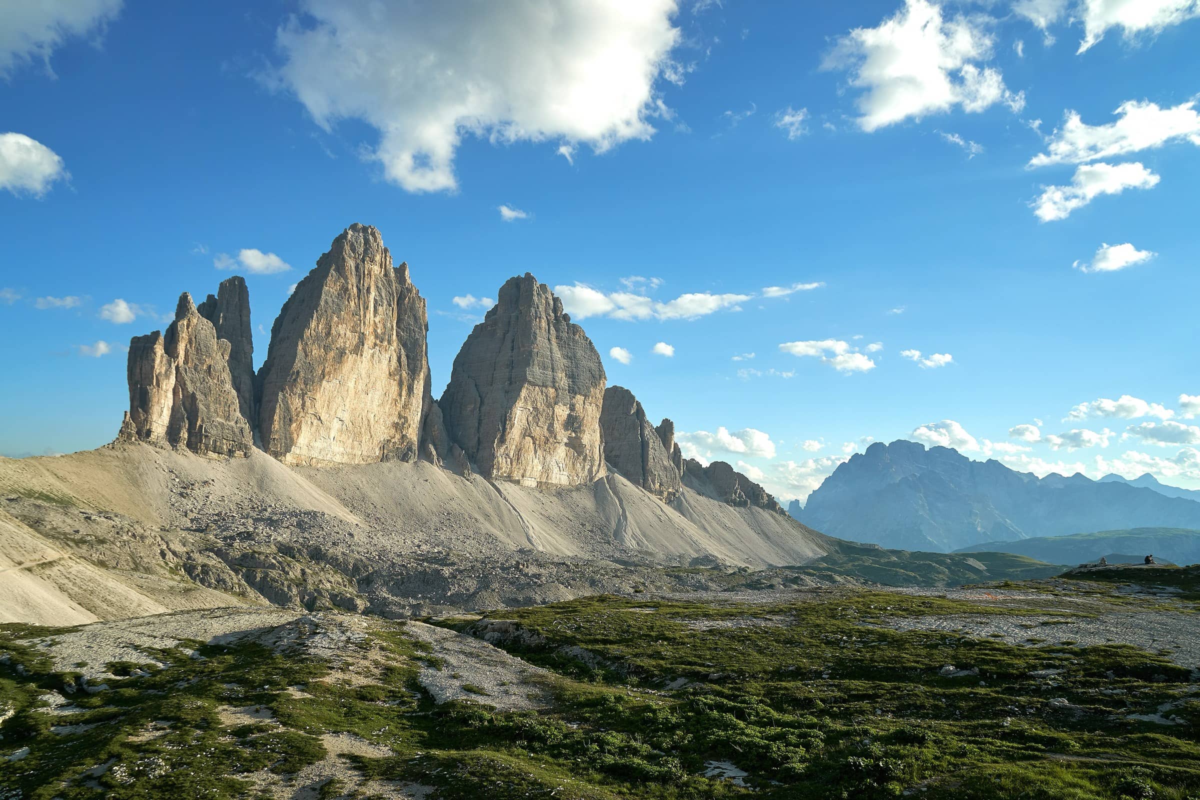
Photo: Alessandro Drago · CC BY-SA 4.0
The Dolomites were added to the UNESCO World Heritage List on 26 June 2009, for the beauty of their landscape and their geological importance. The site is a series of nine separate mountain systems, and the Tre Cime di Lavaredo (Drei Zinnen in German) sit in the Northern Dolomites system, on the border between the Veneto region and South Tyrol. Their three towers are probably the most photographed peaks in the range, and walking around them is a great first taste of Dolomites hiking.
This guide covers the loop itself, how to get to the trailhead under the 2026 rules, how mountain huts (rifugi) work, and the bigger multi-day route many hikers move on to: the Alta Via 1.
The Tre Cime loop
The loop starts at Rifugio Auronzo, on the south side of the peaks. The 3 Zinnen Dolomites tourism board lists the round trip as 8.8 km (about 5.5 miles), around 4 hours of walking, with about 550 m (about 1,800 feet) of ascent and descent. It rates the hike as easy, on well-kept trails.
From Rifugio Auronzo, trail no. 101 passes Rifugio Lavaredo and climbs gradually to Forcella Lavaredo (Paternsattel), about an hour from the start. This is where the 500-metre-high north faces of the three peaks come into view. Beyond the saddle the trail dips under Monte Paterno to a fork: one branch climbs easily to Rifugio Locatelli (Dreizinnenhütte), while trail no. 105 heads to the Langalm hut and its lake, then back along the west side of the peaks to the start.
Getting there: the toll road in 2026
The road up from Misurina to the Rifugio Auronzo car park is managed by the Municipality of Auronzo di Cadore. Since summer 2025, cars can only reach the car park with an online reservation made through the official portal, auronzo.info. The portal shows available days and time slots in real time. When booking, you give an email address, a phone number and the license plate of the vehicle.
The municipality reopened the road for the 2026 season on 23 May 2026. Its published 2026 rates are €40 per car, €26 per motorcycle and €60 per camper or motorhome. The local tourism consortium says the road is generally open from late May to late October, weather permitting.
Prefer not to drive? The tourism board points to the line 444 shuttle bus from Dobbiaco/Toblach via Misurina to Rifugio Auronzo, and the Auronzo-Misurina consortium runs local buses from June. Timetables and booking rules change each season, so check the South Tyrol public transport site (sii.bz.it) and the consortium's website before you go. You can also hike in on foot from the valleys, for example from Landro in the Rienza valley or from the Fischleintal and Innerfeldtal valleys near Sexten and Innichen.
How rifugi work
Rifugi are staffed mountain huts that serve meals and, at many of them, offer beds in shared rooms. Rifugio Auronzo, for example, is run directly by the local CAI section of Auronzo. Huts owned by the Italian Alpine Club follow a common set of rules, and they are a good guide to etiquette across the range.
Under the CAI rules, booking a bed is recommended for everyone and required for groups of more than ten. You can book through the hut's own channels (website, phone or email) or the CAI's Prenota Rifugi platform, and a booking only counts once the hut manager confirms it. Unless you agree otherwise, your bed is held until 6 pm on your arrival day, so call ahead if you're running late. The manager may ask for a deposit of up to one night's price.
Once you're there, a few house rules apply. Leave your climbing gear in the dedicated room or outside, and take your boots off indoors. A personal sleeping sheet (sacco lenzuolo) is mandatory for overnight stays; ask the manager if you don't have one. Respect quiet hours, keep noise down on early starts, fold your blankets, and carry out all your trash. Smoking, music speakers and drying clothes on heaters are not allowed. CAI members get discounted rates, so if you plan several hut nights in Italy, it may be worth joining CAI or a club with a reciprocal agreement.
“Book the road and the beds before anything else, bring a sleeping sheet, and plan to be off high ground before the afternoon storms build.”
— Great Hikes team
Going further: the Alta Via 1
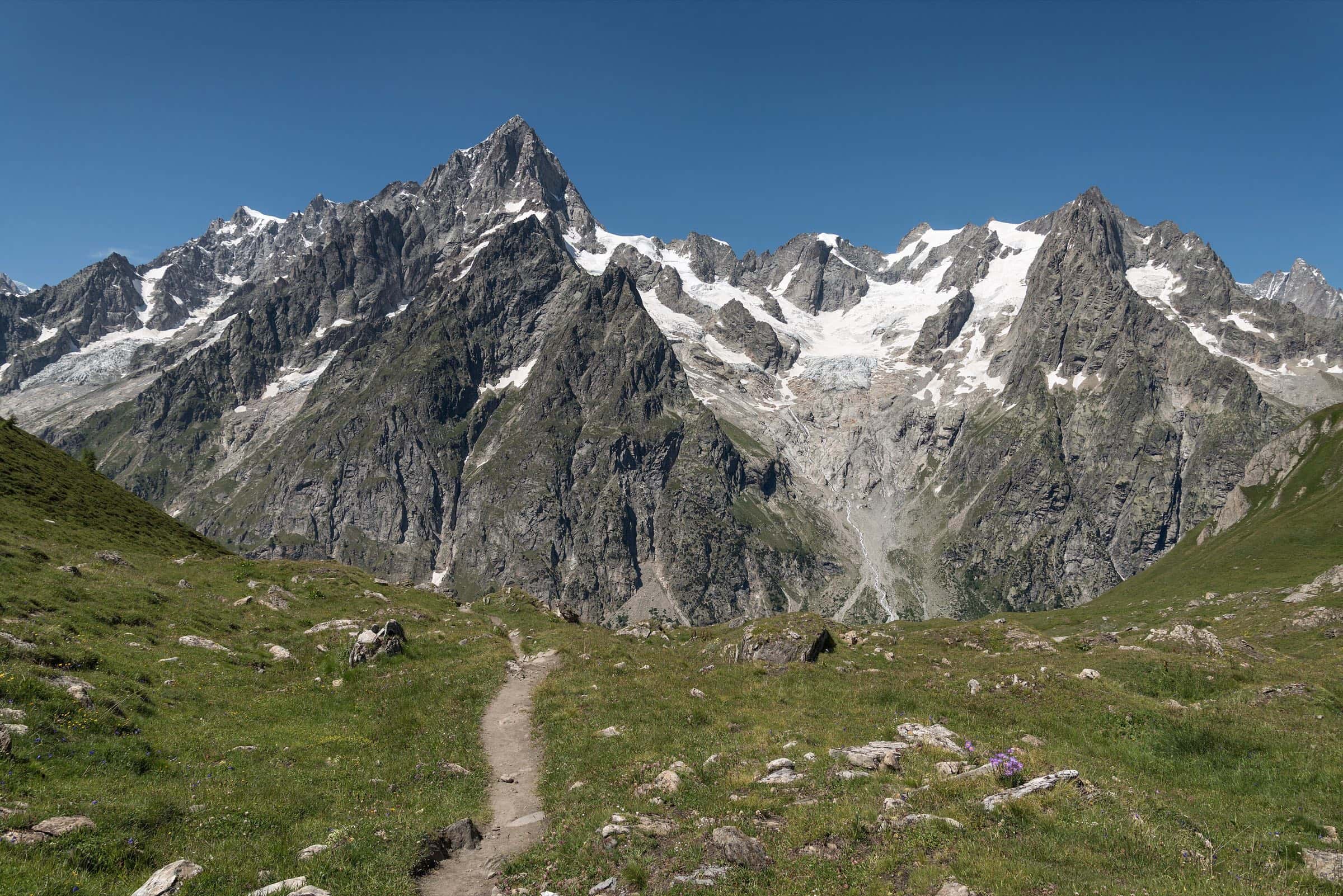
If the Tre Cime loop leaves you wanting more, the Alta Via 1 is the classic hut-to-hut route through the eastern Dolomites. The CAI describes it as about 125 km (about 78 miles) with around 7,300 m of elevation gain, running from Lago di Braies (Pragser Wildsee) to the city of Belluno in 12 stages. Along the way it links rifugi such as Biella, Fanes, Lagazuoi, Nuvolau, Croda da Lago, Vazzoler, Carestiato, Sommariva, Pian de Fontana and 7° Alpini.
The CAI calls the main route not particularly challenging for a good hiker, with fixed aids on the hardest sections. Optional variants add via ferrata sections and summits for more experienced hikers. Plan to book each night in advance and check each hut's opening dates.
A note on via ferrata
Many Dolomites routes include via ferrata, protected climbing paths with fixed steel cables and ladders. They are not hiking trails. CAI safety material says you need certified gear and must know how to use it: a climbing helmet, a harness and a via ferrata energy-absorbing set built to the EN 958 standard. Put your helmet on first, because rockfall from climbers above is common. Modern textile absorbers can't be reused after a fall. Avoid via ferrata in rain, snow, wind or when storms threaten. If you're new to it, go with a certified mountain guide.
Weather and thunderstorms
The CAI warns that summer thunderstorms, especially heat-driven ones, are a serious risk in the mountains. In unstable conditions, cumulus clouds can grow quickly through the morning and break into storms in the afternoon. Check a reliable, up-to-date forecast before you set out, start early, and watch the sky. If a storm hits, look for shelter right away and stay clear of isolated trees, exposed rock, ridges and metal objects. The 3 Zinnen tourism board names June to September as the main hiking season, with quieter trails and strong colors in autumn.
More Italian classics
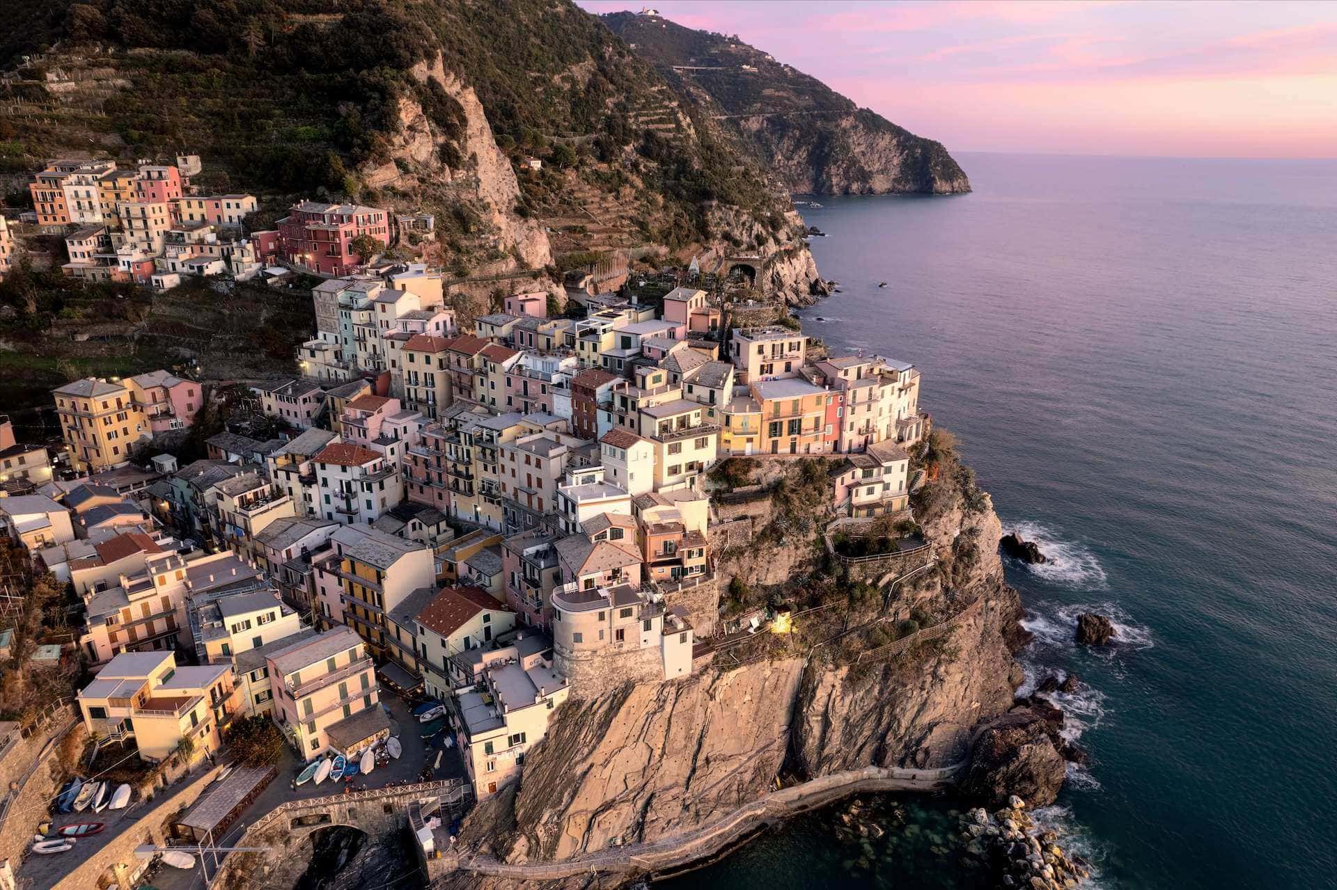
Want to pair the mountains with the sea? The coastal paths between the five villages of the Cinque Terre make a great contrast to a week in the Dolomites.
Road reservations, fees, bus timetables, hut opening dates and trail conditions change often. Always check current information with the Municipality of Auronzo di Cadore and auronzo.info, the hut you plan to stay at, and the CAI before you go.
Sources
- Dolomites UNESCO Foundation – The Dolomites UNESCO World Heritage site
- Dolomites UNESCO Foundation – Rifugio Locatelli in the 'Rifugi delle Dolomiti UNESCO' project (Northern Dolomites system)
- 3 Zinnen Dolomites tourism board – Summer walk around the Drei Zinnen/Tre Cime
- 3 Zinnen Dolomites tourism board – Three Peaks: hikes, getting there, parking and best time to visit
- Comune di Auronzo di Cadore – Tre Cime di Lavaredo (incl. 2026 parking tariffs PDF)
- Comune di Auronzo di Cadore – Riapertura della strada delle Tre Cime di Lavaredo (22 May 2026)
- Consorzio Turistico Tre Cime Dolomiti – Tre Cime di Lavaredo (road reservation, season, buses)
- Rifugio Auronzo – official site
- CAI – Regolamento strutture ricettive del Club Alpino Italiano (hut booking and house rules)
- CAI – Circolare n. 15/2025, Tariffario Rifugi 2026
- CAI Prenota Rifugi – High Way No. 1 Dolomiti (Alta Via 1)
- Cortina d'Ampezzo tourism – Alta Via n. 1 stages and huts
- CAI Prenota Rifugi – Maltempo in montagna: rischi e raccomandazioni
- CAI / CNSAS Sicuri in Montagna – Sicuri in ferrata
- CAI Lo Scarpone – Set da ferrata: novità tecniche e raccomandazioni sul corretto utilizzo